You are here
Use of and the border on Rainy River
Tue, 2009-03-31 10:15
About six weeks ago I wrote a column about how the United States has launched unmanned drones to patrol the border with us.
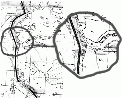
I have often wondered how the border is determined and a few weeks ago Don Beyak of Rainy River sent in this map explaining how it is.
Apparently there are survey markers on both sides of the river and halfway between them is the actual border.
Beyak said there is one of these markers at the Pines Park.
He also produced a portion of an 1842 treaty that states: "All water-communications, and all the usual portages along the line from Lake Superior to the Lake of the Woods...as now actually used, shall be free and open to the use of the citizens and subjects of both countries."
–Until then,
Ken